


The first flood in St. Petersburg occurred three months after the city was founded. Since then, more than three hundred floods have happened in the city. In order to monitor the rise of water and to alert to possible flooding, in 1707 a water level gauge service (water level gauge is a rule which measures the tide level) was founded in Kronshtadt. In 1840, the Stone Bridge in Kronshtadt was marked with a zero mark — the average water level of the Baltic Sea for 14 years. It has been updated several times — the last copper plaque and water level gauge was installed in 1951.
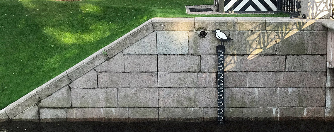
This mark is called the zero of the Kronshtadt water level gauge or zero of the Baltic Height System, from which altitudes on land and depths of the seas are measured in Russia and the countries of the former Soviet Union. The Russian level net is measured against the zero of Kronshtadt water gauge. To determine the water level in the waters of the Neva with the help of the New Holland Island water gauge, one needs to correlate its values with the zero mark of Kronshtadt.
Since our water gauge is 1,26 meters below the Kronshtadt one, 1,26 meters must be subtracted from its value. For example, if our gauge shows 2 meters, it means that the water level is 74 centimeters according to the Baltic Height System Unification: 2 m – 1,26 m = 0,74 m
Since the Baltic Height System relies on long-term average sea levels, water level values can sometimes show a negative meaning, and this is not a mistake. For example, if our gauge shows 1 metre, it means that the water level is 26 centimeters below zero in the Baltic Height System: 1m – 1,26 m = – 0,26 m
After 32 years of construction, the St. Petersburg Flood Protection Complex, or the dam, as it is better known to residents, commenced operation in 2011. The complex stretches for 25,4 km from Bronka to Gorskaya via Kronshtadt and protects the city from even the most severe floods, withstanding waves up to 3,5 meters high. The maximum height of the dams is 7,5 meters, but the complex also includes culverts (for free water exchange between the Neva Bay and the Gulf of Finland) and ship-crossing facilities (for the passage of ships to the seaport of St. Petersburg). The Complex also has the Circular Road running through it.
